3D laser scanning for buildings
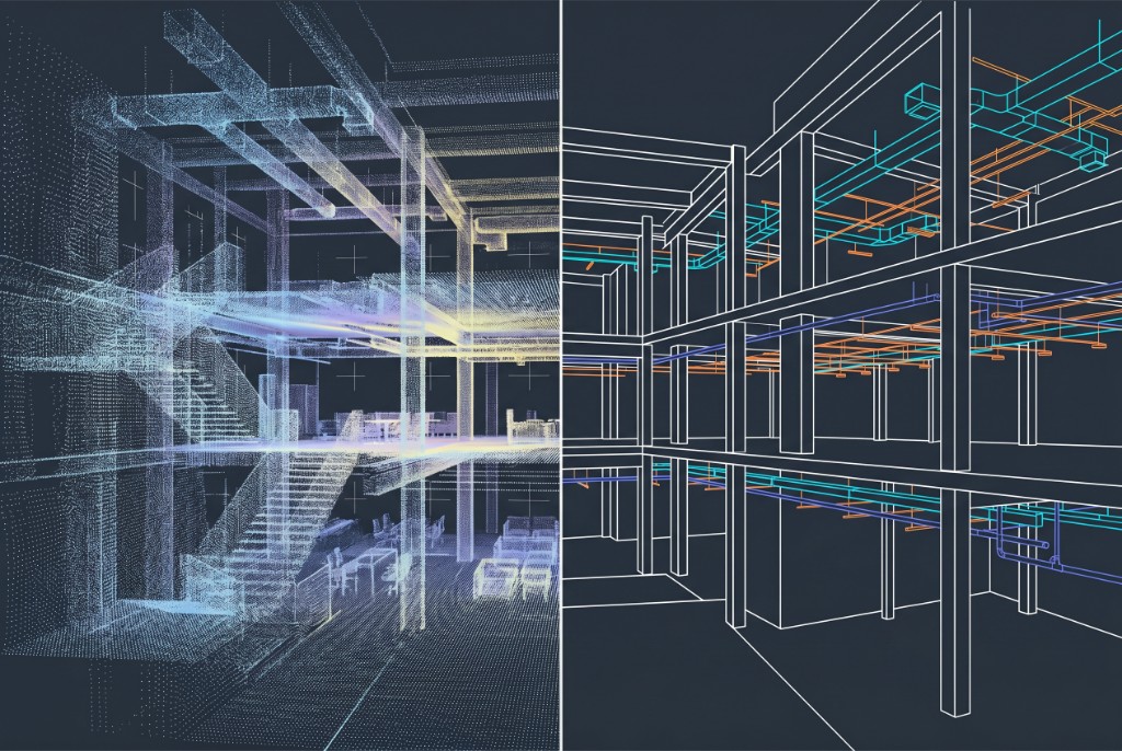
3D laser scanning for buildings captures the as-built geometry of commercial, institutional, and multi-story structures as a dense point cloud—then uses that data for verification, Scan-to-BIM, renovation design, and coordination. Laser scanning for a building is one of the most common applications of 3D laser scanning in construction when teams need measurable field truth instead of outdated drawings.
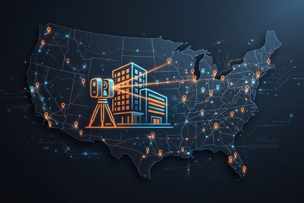
Black Forge Technology provides nationwide building laser scanning across the continental United States, from single-floor tenant improvements to full-campus documentation—including off-hours capture when occupied sites cannot shut down during the day.
What is 3D laser scanning for buildings?
A 3D laser scanner measures distances to surfaces millions of times per second, producing a registered point cloud of walls, structure, MEP, ceilings, and envelope conditions. For buildings, that capture supports:
- As-built documentation when record drawings do not match field conditions
- Renovation and TI — Design and coordinate against real geometry
- Scan-to-BIM — Model existing conditions at an agreed LOD for retrofit or addition work
- Verification — Compare installed work or deviations to the design model
If you are new to the technology, start with what is 3D laser scanning in construction for the broader site and QC context (including concrete FF/FL).
Laser scanning for a building vs. a construction site
Building work emphasizes interiors, envelope, and occupancy-driven access. Site and civil work emphasizes terrain, alignment, and weather. Both use the same core capture technology; scope and deliverables differ.
| Building scanning | Site / civil scanning |
|---|---|
| Interior + envelope focus | Terrain, utilities, infrastructure |
| Often tied to Scan-to-BIM and TI | Often tied to volume, alignment, or as-built civil |
| Access and occupancy drive schedule | Weather and ground conditions drive schedule |
| Night or off-hours common on occupied buildings | Daylight and safety perimeters often define access |
When teams scan a building
- Renovation and tenant improvement — Document existing walls, ceilings, MEP, and structure before design.
- As-built vs design — Compare field conditions to the model to catch deviations early.
- Scan-to-BIM — Convert scans into a BIM for coordination on retrofit or addition work.
- Facade and envelope — Capture curtain wall, cladding, or irregular exterior geometry.
- Core, shell, and structure — Document steel, concrete, and shafts for additions or seismic work.
- Multi-building campuses — Consistent control and registration across several structures.
- Historic or complex geometry — Atriums, irregular facades, or structural steel that is hard to measure by hand.
- Handover and facilities — Create an accurate digital record for operations and future capital projects.
Building types we scan
We focus on commercial and institutional facilities—not residential home scanning.
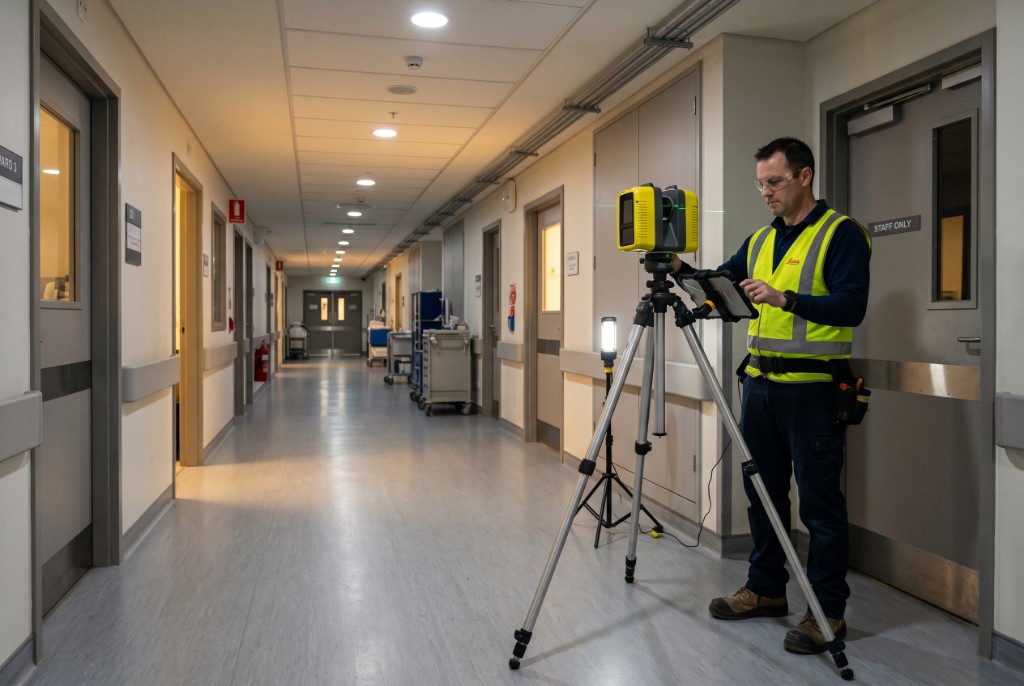
- Healthcare — Hospitals, clinics, and medical office buildings; night or off-hours access is common. See night laser scanning for occupied healthcare and retail.
- Education — K–12, higher ed, and research buildings with varying occupancy during breaks or nights.
- Office and corporate — Towers and campuses for TI, MEP upgrades, and landlord coordination.
- Retail and hospitality — Stores, malls, and hotels where operations limit daytime access.
- Industrial and warehouse — Large clear spans, equipment layouts, and production areas.
- Public and institutional — Civic, cultural, and government facilities where as-built records are incomplete.
The workflow is consistent: project control, scan positions on site, registration and QA, then deliverables aligned to your contract.
Our process
- Scope and access — Define areas, floors, interior vs exterior, occupancy windows, and target deliverables (point cloud, TruViews, 2D extracts, Scan-to-BIM LOD).
- Control and planning — Establish survey control or tie to project benchmarks so scans align with design coordinates.
- Field capture — Multiple scan positions to cover rooms, corridors, and structure with overlap for clean registration.
- Registration and QA — Align scans, check against control, and prepare data for delivery or modeling.
- Deliverables — Issue agreed outputs (see below); optional modeling pass for Scan-to-BIM.
Timelines depend on square footage, complexity, access—not just scan day count.
Deliverables from a building laser scan
| Deliverable | Typical use |
|---|---|
| Registered point cloud (E57, RCS, or native) | Measurement, visualization, archive |
| TruViews or virtual walkthroughs | Owner, design team, and field review without revisiting site |
| 2D plans and sections | Drawing supplements when BIM is not required |
| Revit / BIM at agreed LOD | Design, coordination, prefab, and TI workflows |
| Verification or clash reports | Compare as-built to design or between trades |
Scan-to-BIM scope should name element types and LOD up front—see what is Scan-to-BIM for the full workflow. Deliverables above can be combined: many teams take a registered point cloud first, then add modeling when design needs a coordinated BIM.
Nationwide building laser scanning (continental U.S.)
Black Forge mobilizes for 3D laser scanning for buildings anywhere in the continental United States. Whether your project is on the East Coast, Midwest, Southwest, or West Coast, we plan travel, equipment, and schedule around your access windows—not the other way around.
To request a proposal, share:
- Project location (city/state and site constraints)
- Approximate area (SF and number of floors)
- Scope (interior, exterior, disciplines, Scan-to-BIM yes/no)
- Access (day vs night/off-hours, occupied vs vacant)
- Target dates and deliverable format
Use the 3D scanning services contact form or contact us directly.
Occupied buildings and night scanning
Many building projects cannot shut down during the day. Laser scanning on night shifts (or early-morning windows) captures corridors, patient areas, retail floors, or production space when foot traffic and operations are lowest.
Night or off-hours scanning typically requires:
- Clear access windows — Which areas, elevators, and paths are available.
- Safety and coordination — Building security, escorts, and any live systems in the scan path.
- Lighting — Scanners work in low light; consistent conditions help registration and color imagery when needed.
If your schedule is driven by occupancy—not by lack of interest in scanning—ask about off-hours mobilization when you request a quote.
Accuracy and quality
Building scans typically achieve millimeter-level accuracy when control and scanner setup match the environment. Factors include scan density, line-of-sight, vibration, and how the data will be used.
For QA practices and how scanning reduces rework, see how 3D laser scanning improves construction accuracy. When the deliverable is a coordinated model—not just a cloud—pair capture with BIM/VDC consulting for Scan-to-BIM workflows.
Laser scanning vs. traditional as-built survey
| Traditional survey / manual measure | 3D laser scanning for buildings |
|---|---|
| Spot dimensions and selective shots | Dense, full-room and full-surface capture |
| Slower on complex or irregular geometry | Faster documentation of atriums, MEP-heavy areas, facades |
| Harder to revisit without another site visit | Permanent point cloud for future extraction |
| May miss conditions between measure points | Supports verification and Scan-to-BIM at scale |
Scanning does not replace engineering judgment—it gives teams complete, measurable as-built data for design and coordination.
Timeline and pricing factors
We do not publish flat rates; every building differs. Cost and schedule usually depend on:
- Square footage and floor count
- Interior only vs interior + exterior / facade
- Occupancy and access (day vs night mobilization)
- Deliverables — Point cloud only vs 2D extracts vs Scan-to-BIM at a specific LOD
- Travel and duration on site
- Modeling complexity (MEP density, historic geometry, multi-building registration)
Share scope early—we will respond with a custom proposal and realistic field + delivery windows.
Frequently asked questions
What is 3D laser scanning for buildings?
3D laser scanning for buildings uses LiDAR and imaging to capture the as-built geometry of commercial and institutional structures as a dense point cloud. Teams use that data for renovation design, as-built verification, Scan-to-BIM, coordination, and facilities documentation.
What is laser scanning for a building used for?
Laser scanning for a building documents existing conditions when drawings are outdated or incomplete—before tenant improvements, MEP retrofits, facade work, or Scan-to-BIM modeling. It also supports as-built vs design comparison and owner handover records.
Do you provide 3D laser scanning for buildings nationwide?
Yes. Black Forge Technology mobilizes for 3D laser scanning for buildings across the continental United States—from single-floor TI to multi-building campuses. Request a proposal with project location, approximate square footage, and access windows.
How accurate is building laser scanning?
Building laser scans typically achieve millimeter-level accuracy when control and scanner setup match the environment. Accuracy depends on scan density, registration, and how the point cloud will be used (verification vs modeling at a specific LOD).
Can you laser scan an occupied building?
Yes. Occupied hospitals, retail, offices, and similar sites often schedule night or early-morning scanning when corridors and work areas are available. Coordination with building security, escorts, and access windows is required.
How long does it take to 3D laser scan a building?
Field capture may take one day to multiple days depending on square footage, number of floors, complexity, and access. Registration, QA, and deliverables (point cloud only vs Scan-to-BIM) add time after the site visit—scope drives the schedule.
What deliverables do you provide from a building scan?
Deliverables may include registered point clouds (e.g., E57 or native formats), TruViews or similar virtual walkthroughs, 2D plans and sections, clash or verification reports, and Revit/BIM elements at an agreed LOD when Scan-to-BIM is in scope.
What is the difference between laser scanning and Scan-to-BIM for buildings?
Laser scanning captures field geometry as a point cloud. Scan-to-BIM converts that data into modeled building elements in tools such as Revit for design and coordination. Many projects need scanning only; others need both capture and modeling.
How much does 3D laser scanning a building cost?
Cost depends on square footage, interior vs exterior scope, number of scan positions, occupancy and access constraints, travel, and whether you need point cloud only or full Scan-to-BIM at a defined LOD. We provide custom proposals—no flat rate without scope.
Do you scan healthcare, retail, and institutional buildings?
Yes. We scan healthcare, education, office, retail, hospitality, and industrial facilities—commercial and institutional work, not residential home scanning. Off-hours mobilization is available when operations cannot pause during the day.
Related content
- What is 3D laser scanning in construction?
- What is Scan-to-BIM?
- 3D scanning services — Nationwide laser scanning, Scan-to-BIM, FF/FL
- Night laser scanning for occupied sites
- BIM/VDC consulting — Scan-to-BIM workflows and coordination
Black Forge Technology can help — We provide 3D laser scanning for buildings nationwide across the continental U.S., including off-hours work when the site requires it. Contact us or request a scanning proposal.